OpenStreetMap - Holger Schöner PDF
Preview OpenStreetMap - Holger Schöner
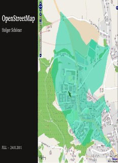
OpenStreetMap Holger Schöner FLLL – 24.01.2011 Overview • OpenStreetMap Pick your favourite Role • As User • Maps, Navigation • As Mapper • Data, Editors • Sources • Current State • As Developer • Database • Tools • As Artist • Rendering for Print/Web • As a Philosophy • License, License Switch • Organisations, Politics and Business Holger Schöner • OpenStreetMap • FLLL • 24.01.2011 The OpenStreetMap Project • Founded 2004, by Steve Coast in UK ”OpenStreetMap creates and provides free geographic data such as street maps to anyone who wants them. The project was started because most maps you think of as free actually have legal or technical restrictions on their use, holding back people from using them in creative, productive, or unexpected ways.” • Since about 2006, infrastructure is in place for large scale mapping; since then an exploding number of participants 01/2011: 340,000 registered users, 12,000 active/m., 900 mil. nodes • Very community oriented — wiki.openstreetmap.org Wiki, email lists, irc, forums, mapping parties, local groups • Creation of more formal organization OSMF: Collection of donations, servers, ”support”, local chapters Marketing, Press and legal contact — License change Holger Schöner • OpenStreetMap • FLLL • 24.01.2011 1 OSM for MapUsers • Maps • Different formats: Bitmaps, PDF, SVG, VectorMaps (Shp, Img, ...) • Various styles: Street maps, hiking, public transportation, railways, skiing, ... • Liberal license • Very fine details, but not homogenous • Regions for which no other web maps are available/as detailed • Very uptodate • Navigation • Routing for different transportation modes (with appr. details) • Webrouting www.openrouteservice.org, wwww.yournavigation.org, maps.cloud made.com, open.mapquest.com, ... • Devices: iPhone, Android, Garmin, Skobbler, ... • Correct the errors you spot quickly yourself Holger Schöner • OpenStreetMap • FLLL • 24.01.2011 2 OpenCycleMap opencyclemap.org ÖPNVKarte öpnvkarte.de Wanderkarte topo.geofabrik.de OpenSeaMap openseamap.de TopOSM toposm.com OpenRouteService openrouteservice.com Reachability in 1min
Description: