NASA Technical Reports Server (NTRS) 20120008257: TRMM Precipitation Application Examples Using Data Services at NASA GES DISC PDF
Preview NASA Technical Reports Server (NTRS) 20120008257: TRMM Precipitation Application Examples Using Data Services at NASA GES DISC
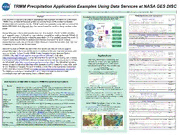
TRMM Precipitation Application Examples Using Data Services at NASA GES DISC Zhong Liu1,2([email protected]), D. Ostrenga1,3, W. Teng1,4, S. Kempler1, and M. Greene1,4 1 NASA Goddard Earth Sciences (GES) Data and Information Services Center (DISC), 2 George Mason University, 3 ADNET, 4 WYLE Abstract Precipitation Data And Information Services Center (PDISC) at the Goddard Earth Sciences (GES) DISC Data services to support precipitation applications are important for maximizing the NASA TRMM (Tropical Rainfall Measuring Mission) and the future GPM (Global Precipitation Mission) mission’s societal benefits. TRMM Application examples using data services at the NASA GES DISC, including samples from users around the world will be presented in this poster. Precipitation applications often require near-real-time support. The GES DISC provides such support through: 1) Providing near-real-time precipitation products through TOVAS; 2) Maps of current conditions for monitoring precipitation and its anomaly around the world; 3) A user friendly tool (TOVAS) to analyze and visualize near-real-time and historical precipitation products; and 4) The GES DISC Hurricane Portal that provides near-real-time monitoring services for the Atlantic basin. Since the launch of TRMM, the GES DISC has developed data services to support precipitation applications around the world. In addition to the near-real-time services, other services include: 1) User friendly TRMM Online Visualization and Analysis System (TOVAS; URL: http://disc2.nascom.nasa.gov/Giovanni/tovas/); 2) Mirador (http://mirador.gsfc.nasa.gov/), a simplified interface for searching, browsing, and ordering Improving World Agricultural Supply and Earth science data at GES DISC. Mirador is designed to be fast and easy to learn; 3) Data Demand Estimates by Integrating NASA via OPeNDAP (http://disc.sci.gsfc.nasa.gov/services/opendap/). The OPeNDAP provides Data and Technologies into USDA World remote access to individual variables within datasets in a form usable by many tools, such Agricultural Outlook Board Decision Making as IDV, McIDAS-V, Panoply, Ferret and GrADS; and 4) The Open Geospatial Consortium Environment (OGC) Web Map Service (WMS) (http://disc.sci.gsfc.nasa.gov/services/wxs_ogc.shtml). NASA ROSES NNH08ZDA001N-DECISIONS The WMS is an interface that allows the use of data and enables clients to build Historical analog year comparisons for crop customized maps with data coming from a different network. yield forecasts (Parana, Brazil; soybeans) Data Services at GES DISC to Support TRMM Precipitation Applications Service Description WMO station precipitation TRMM 3B42-V6 precipitation • WMO station and TRMM 3B42-V6 precipitation data both Mirador (from Spanish, a place providing a wide view) is a Google-based data archive resulted in the same analog year (2004-05) for the target year of Mirador search interface that allows searching, browsing, subsetting, format conversion, and (2008-09). ordering of Earth science data at NASA GES DISC. • Complementary nature of satellite and weather station data, in TRMM Online Visualization and Analysis System: A member of The GES-DISC Interactive identifying analog years, implies the possibility of “calibrating” TOVAS Online Visualization ANd aNalysis Infrastructure (Giovanni) is the underlying infrastructure the analog analysis methodology in station-rich areas, to be then for a growing family of Web interfaces that allows users to analyze gridded data applied in station-poor areas of the world. interactively online without having to download any data. TRMM read Read in a TRMM HDF data file, and write out user-selected SDS arrays and Vdata tables software as separate flat binary files. NASA TRMM Precipitation Data for Monitoring Simple Subset A simple spatial subset tool to allow spatial subsetting and outputs are in NetCDF or ASCII. Wizard Crop Conditions REVERB Refine your granule search with the NASA-developed Earth Observing System (EOS) http://daac.gsfc.nasa.gov/agriculture/ (Funded by NASA’s REASoN CAN-02-OES-01) Clearinghouse (ECHO) next generation Earth Science discovery tool 10 Day Precipitation required for the USDA Foreign a stable, secure data server that provides subsetting and analysis services across the Agricultural Service (FAS) Crop Explorer GrADS Data Server internet. The core of the GDS is OPeNDAP (also known as DODS), a software framework used for data networking that makes local data accessible to remote locations. The Open Source Project for a Network Data Access Protocol (OPeNDAP) provides OPeNDAP remote access to individual variables within datasets in a form usable by many tools, such as IDV, McIDAS-V, Panoply, Ferret and GrADS. The Open Geospatial Consortium (OGC) Web Map Service (WMS) is a service that OGC Web Map provides map depictions over the network via a standard protocol, enabling clients to build Service customized maps based on data coming from a variety of distributed sources.
