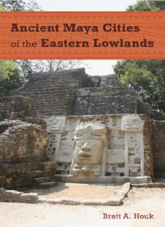
Ancient Maya Cities of the Eastern Lowlands PDF
Preview Ancient Maya Cities of the Eastern Lowlands
Ancient Maya Cities of the Eastern Lowlands Ancient Cities of the New World University Press of Florida Florida A&M University, Tallahassee Florida Atlantic University, Boca Raton Florida Gulf Coast University, Ft. Myers Florida International University, Miami Florida State University, Tallahassee New College of Florida, Sarasota University of Central Florida, Orlando University of Florida, Gainesville University of North Florida, Jacksonville University of South Florida, Tampa University of West Florida, Pensacola This page intentionally left blank Ancient Maya Cities of the Eastern Lowlands Brett A. Houk Foreword by Marilyn A. Masson, Michael E. Smith, and John W. Janusek University Press of Florida Gainesville / Tallahassee / Tampa / Boca Raton Pensacola / Orlando / Miami / Jacksonville / Ft. Myers / Sarasota Copyright 2015 by Brett A. Houk All rights reserved Printed in the United States of America on acid-free paper This book may be available in an electronic edition. 20 19 18 17 16 15 6 5 4 3 2 1 A record of cataloging-in-publication data is available from the Library of Congress. ISBN 978-0-8130-6063-7 University Press of Florida 15 Northwest 15th Street Gainesville, FL 32611-2079 http://www.upf.com For my parents This page intentionally left blank Contents List of Illustrations ix List of Tables xii Foreword xiii Preface xv 1. Ancient Maya Urbanism in the Eastern Lowlands 1 2. Studying Maya Cities 13 3. The Setting in Space and Time 46 4. Preclassic Foundations 69 5. Southern Belize 84 6. Vaca Plateau and Maya Mountains 119 7. Belize Valley 147 8. Northwestern Belize 168 9. Northern Belize 201 10. Comparisons and Urban Planning 232 11. Deciphering Meaning in Maya Cities 265 References Cited 285 Index 327 This page intentionally left blank Illustrations 1.1. Map of the Maya area xviii 1.2. Map of the eastern lowlands 4 2.1. Structure B-3 at Cahal Pech with plaster restored over facing masonry 29 2.2. Idealized cross section of a vaulted masonry building 30 2.3. Structure A-32 on the north face of the Castillo at Xunantunich 31 2.4. Restored Structure E-1 at Cahal Pech 32 2.5. Photograph of a partially collapsed building in Courtyard 100B at La Milpa 41 2.6. Shaded relief map of Chan Chich Structure A-5 with 0.25-m contours overlaid 43 2.7. Contour map of La Milpa Courtyard 100 with rectified map of structures and architectural plan of eastern courtyard wall overlaid 44 4.1. Map of Cahal Pech 72 4.2. Simplified plan map of superimposed Late Preclassic Structures 14 and 15 buried in the plaza at the Tolok Group, Cahal Pech 73 4.3. Eastern profile Structure B1 at Blackman Eddy 74 4.4. Map of Cerros with inset of Central Precinct 81 5.1. Map of southern and central Belize 85 5.2. Map of Pusilhá 88 5.3. Map of Moho Plaza at Pusilhá 91 5.4. Map of Uxbenka 96 5.5. Map of Uxbenka’s Stela Plaza 97 5.6. Map of Uxbenka Groups B–F 99 5.7. Map of Lubaantun 105 5.8. Photograph of Structure 12 at Lubaantun 106 5.9. Photograph of Plaza V at Lubaantun 107
Description: