1040_musinsky_2017 NEON AOP Flight Campaign PDF
Preview 1040_musinsky_2017 NEON AOP Flight Campaign
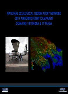
NATIONAL ECOLOGICAL OBSERVATORY NETWORK 2017 AIRBORNE FLIGHT CAMPAIGN DOMAINS 18 TUNDRA & 19 TAIGA John Musinsky, Staff Scientist, NEON Airborne Observation Platform 1 National Ecological Observatory Network NEON – by Subsystem TIS - Terrestrial Instrumented System AIS – Aquatic Instrumented System TOS – Terrestrial Observation System AOS – Aquatic Observation System AOP – Airborne Observation Platform Remote Sensing Payloads 2 NEON Science Payloads plus 1 Assignable Asset Payload • VSWIR imaging spectrometer (AVIRISng) • 1064 nm waveform lidar • High resolution digital camera 4 Airborne RS Data Products - Current Hyperspectral Data Surface reflectance (recorded across 426 spectral bands, 380-2510nm) Vegetation Indices (NDVI, EVI, ARVI, SAVI) NDVI EVI ARVI Xanthophyll Lignin fPAR Canopy Nitrogen - Canopy Lignin - Canopy NDNI NDLI Xanthophyll LAI Water Indices (WBI, NDII, NDWI, MSI, NMDI) Albedo Water Band Water Index - Moisture Stress Index NDWI Index ND Infrared fPAR LAI Index 5 Airborne RS Data Products - Current Lidar Data DSM (Digital Surface Model; full mosaic) DTM (Digital Terrain Model; full mosaic) CHM (Canopy Height Model; full mosaic) Slope and Aspect (full mosaics) Classified point clouds (points classified as ground, building, vegetation, and unclassified; 1 km2 tiles) Unclassified point clouds (points by flight line) Elevation uncertainty point cloud KML (site and flight line boundaries) Full waveform data Camera Data Orthorectified digital photographs Camera mosaic 6 Flight Parameters • Minimum sampling area 10km x 10km flight box • Nominal flight altitude 1000m AGL, N/S flight line to minimize BRDF effects • 1 m spectroscopy • ~4 ppm lidar • 10 cm photography • GPS base station (or 1 sec CORS) within 20km of flight line • Solar angles >40° (>35° in Alaska) • Cloud cover <10% 7 Sampling of Ecologically Relevant Areas Land Cover / 2000-2012 Forest Change Average Annual Minimum Temperature (1981-2010) Average Annual Precipitation (1981-2010) Watersheds / Topography Minimum 10km x 10km Priority 1 flight boundaries and delineation of Priority 2 flight boundaries are designed capture: 1) Landscape heterogeneity 2) Key ecological features/processes (e.g., climate patterns, hydrology) related to science themes 8 NEON Domain 18 & 19 Terrestrial and Aquatic Sites 9 Phenological Constraints – Domain 18 (Tundra) 10
Description: